The Relief rendering: the Earth in 3D, in the style of your choice
From the plaster model to atlas tints
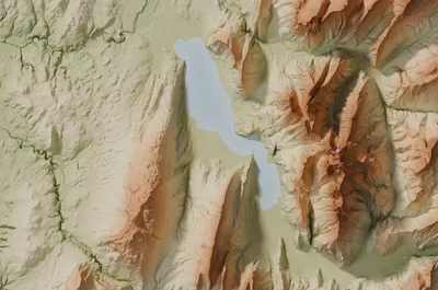
The Relief rendering turns the elevations of the land into a three-dimensional map, lit like a scale model. Mountains rise, valleys deepen, snowy summits appear in white.
How it is made
The relief comes from digital terrain models. In some fifteen countries, including France, Switzerland, Spain, Italy, the United States and Japan, we use the national bare-ground model, measured to the metre, for areas up to 2,000 km². Elsewhere, and for the largest areas, the global Copernicus DEM, at 30 metres.
Along the coasts, the sea floors are drawn from nautical charts: SHOM in France, EMODnet in European seas, GMRT elsewhere. The relief is lit like a scale model and accentuated to stay readable at the scale of the poster.
Eight styles
- Relief: olive and khaki plains, sand and ochre hills, brown mountains, snow on the summits, like an atlas map.
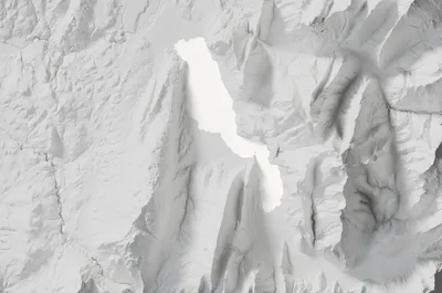
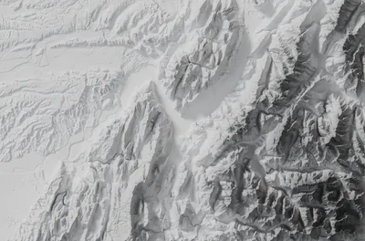
- Plaster: an all-white scale model, where only the light draws mountains and valleys.
- Graphite: elevations in shades of grey, from white plains to anthracite mountains.
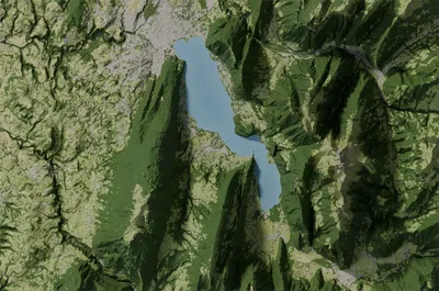
- Realistic: the true colours of the land in summer, forests, meadows, crops, rock and glaciers, from the ESA WorldCover land-cover map.
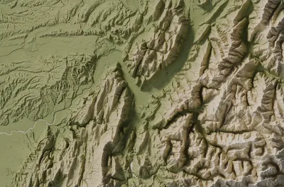
- National park: the olive, khaki and sand tints of national park maps, with a crisp relief.
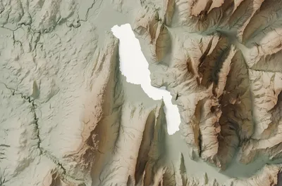
- Sage: a sage grey-green in the plains, sand and umber on the heights, sober and mineral.
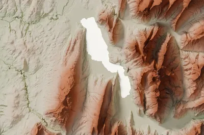
- Terracotta: green plains, pinkish cream plateaus and terracotta and rust summits.
- Olive and old rose: olive and khaki in the plains, powder pink and mauve on the summits.
When you create an image, five styles are ticked: Relief, Plaster, Realistic, Sage and Terracotta. Add or remove some as you like: each style gives an image, and the preview is free. The images below show Lake Annecy in the five styles ticked by default, then the Grenoble area in the Graphite and National park styles.
Strengths
- Anywhere in the world and with no maximum size: a massif, an island, a whole country.
- Eight styles, from minimalist white plaster to atlas tints.
- Sea floors in shades of blue along the coasts.
Good to know
- It is the relief, not a photo: towns and roads do not appear.
- The relief is accentuated to be readable, and a plain stays more discreet than a mountain.
- From 200 km² in the countries with a national relief model, 650 km² elsewhere: at 30 metres, the global model shows forests and villages as small bumps on smaller areas.
Which places?
A massif, a chain of volcanoes, a canyon, a mountainous island, or a whole country. The same area in three styles makes a fine series for a wall: our article Decorating with an image seen from above gives ideas.
Which poster size?
With a national relief model, every size is sharp. With the global model, the thresholds are those of the Satellite rendering: size L (75 × 50 cm) from about 950 km², size XL (90 × 60 cm) from about 1,400 km². The site only offers the sizes that print sharply for your area.
To compare with the other renderings, read Which rendering to choose?.
The Relief rendering in the gallery
Create a relief mapLoading the images…